Surveying Made Simple from the Sky!
Drone-Powered General Surveying & Aerial Inspections
Experience the future of inspections with our drone-powered services. We capture high-resolution aerial data to give you a comprehensive view of your property—efficiently, accurately, and without the hassle.
Service Overview
At Arks Industries, we believe in pushing boundaries. Our drone-powered general surveying and aerial inspections are designed to deliver precise, data-driven insights for a wide range of applications—from construction sites to real estate and infrastructure projects. Let our drones do the heavy lifting while you sit back and review detailed, actionable results.
KEY BENEFITS
Accurate Data Collection
Our drones capture high-resolution imagery and measurements to provide you with exact, reliable data.
Efficient and Non-Invasive
Say goodbye to manual surveys. Our aerial inspections are fast, safe, and completely non-intrusive.
Cost-Effective
Reduce on-site labor and time while increasing the accuracy of your survey reports.
Comprehensive Insights
Enjoy detailed aerial views and data that support smarter decision-making and proactive maintenance.
DETAILED SERVICE SECTION

Advanced Drone Technology
Our state-of-the-art drones are equipped with high-resolution cameras and sensors, ensuring every detail is captured with pinpoint accuracy.

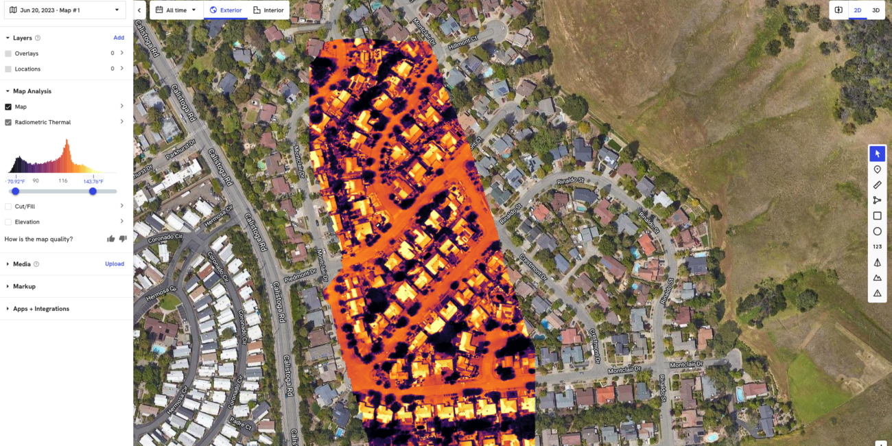
Precision Data Collection
We use cutting-edge technology to measure distances, capture aerial imagery, and generate detailed maps—providing you with a clear picture of your property’s condition.
Expert Analysis
Our team of professionals interprets the data to produce comprehensive reports, highlighting key insights and actionable recommendations.
HOW IT WORKS
01
INITIAL CONSULTATION
We start with a brief consultation to understand your needs and set up the inspection schedule.
02
AERIAL DATA CAPTURE
Our drone takes flight, performing a thorough survey of your property, capturing all the necessary data from multiple angles.
03
DATA PROCESSING & ANALYSIS
The captured data is processed using advanced software to create detailed maps and comprehensive reports.
04
DELIVERY & RECOMMENDATIONS
You receive an easy-to-understand report outlining our findings, complete with recommendations tailored to your project’s needs.
"Arks Industries transformed our surveying process. Their drone inspections provided us with accurate, high-resolution data in a fraction of the time compared to traditional methods."
Sam D., Construction Manager
"The aerial survey report we received was incredibly detailed and useful for planning our next steps. Their technology truly sets them apart from the competition."
Jamie L., Real Estate Developer


Connect with our team
Ready for an Aerial Advantage?
Elevate your surveying and inspection processes with our drone-powered solutions. Get ready for precision, efficiency, and insightful data that drives smarter decisions.